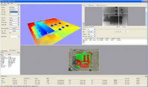
FME Data Inspector GIS Data Paging and Display
Client: Safe Software Description : AlphaPixel developed a virtual-paging database interface to FME’s internal geospatial data store for FME’s OpenSceneGraph-based Data inspector. FME (Feature Manipulation Engine), a spatial ETL (Extract, Transform, Load) tool, contains a sub-module known as Data Inspector for inspecting data at any stage of the data pipeline. This tool pulls data from