Skip to content

lidar

News / Blog

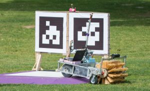
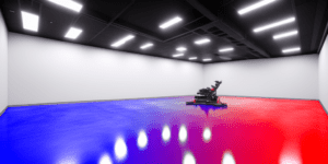
Vision Navigation Part 2a: Implementing a Toy Vision Navigation System

The article explains how to implement a simple vision-based navigation system using OpenCV and Python. It demonstrates a toy example where position metadata is encoded into floor colors, with red and green channels representing X and Y coordinates. Through code examples, the article walks through creating this artificial environment, capturing data with a camera, and processing it to estimate position, orientation, and more advanced navigation techniques.

Read More »
Vision Navigation robot using Aruco/Apriltag style fiducial markers to conduct visual navigation

Vision Navigation Part 1: Overview of Vision Navigation

Vision Navigation is a blanket term that describes using optical-like raster input devices to discover your position and orientation (“pose”) and then use that position to plan, execute and monitor changes in position/pose within the environment. This whitepaper introduces the techniques, strengths and weaknesses, applications and processes of computer vision navigation.

Read More »
Scroll to top