Telemetry

News / Blog

Screenshot of LIDAR data

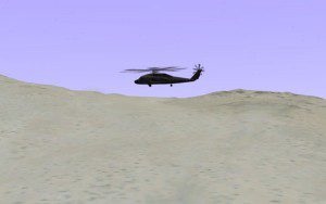
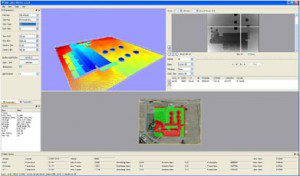
Shader-based LIDAR Simulation

Client: Ball Aerospace Description : AlphaPixel, with Skew Matrix Software contributed training and consulting in support of Ball’s development of a realtime system allowing joystick-driven ‘flight’ of an airborne LIDAR mapping sensor over large-area landscapes built from USGS survey data. Subsequently AlphaPixel provided similar support in the development of shader-based implementation of material surface properties,

Read More »
3D helicopter over desert

3D Multi-Air-Craft Telemetry Black-box Replay Display

Client: Confidential defense contractor Description : AlphaPixel designed and implemented a realtime 3D display to depict the positions and movements of multiple air craft and armaments within a realistic terrain environment, controlled by their “black box” telemetry either from pre-recorded files or live network data sources. The terrain environment was built from real-world GIS data

Read More »
Scroll to top

connect

Have a difficult problem that needs solving? Talk to us! Fill out the information below and we'll call you as soon as possible.

Diagram of satellite communications around the Earth